Ganga nadi - Ghats of Varanasi on the Ganga in India : The cultural landscape reclaimed
INDTRODUCTION
Rarely
has any river gathered in itself so much meaning and reverence as the Ganga has
over three millennia in the Indian subcontinent. The land-water interface on
the Ganga’s banks is fashioned out of the need to access the rising and falling
water levels in the monsoon and dry seasons. The cultural landscape of this
interface—ghats (steps and landings) lined by temples and other public
buildings, pavilions, kunds (tanks), streets and plazas—is layered and kinetic,
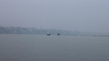
and responsive to the river’s flow. At Varanasi, where the Ganga reverses its
flow northwards, the ghats describe a crescent sweep in a 6.8 km stretch. They
date back to 14th century although they were extensively renovated and extended
in the last three centuries to allow access to the holy Ganga from the temples
and shrines of this ancient city. The narrow streets of old Varanasi end at the
wide landings of the ghats, leading the residents, pilgrims, and tourists to
the river where they worship, bathe and cremate the dead. The ghats are public
commons, ritual spaces, and cremation sites. As such they represent an
extraordinary cultural heritage in their history and as settings for continuing
enactment of ancient traditions that sustain cultural memories, beliefs and
values. The cultural landscape of the ghats evolved in a spatio-temporal order
created from self-organized systems of worship and pilgrimage. Its structure,
complex in its layering and detail and in responding to natural processes was
resilient in its recovery from natural disasters as well as cultural upheavals.
However as the landscape becomes increasingly stressed from intensive use and
ground and water pollution, its irreplaceable heritage is being lost. The
dilapidation of the urban edge due to ill-maintenance, private encroachment,
pollution in the Ganga, and increasing pressures of use caused by three million
visitors every year is stretching its carrying capacity and putting heritage at
risk.
The shift of the river and
silting of banks has impacted the riverfront landscape causing alarm among
conservationists who have been pressing since 2001 to have the riverfront and
the old city nominated in the UNESCO World Heritage List. Varanasi ghats fit
the categories of ‘an organically evolved landscape’ as well as ‘an associative
cultural landscape’ in the cultural landscape criteria. The ghats on the Ganga
have evolved over centuries into the spiritual center of Hinduism. Urban
infrastructure (sanitation, solid waste management, and water supply) has been
upgraded under the Jawaharlal Nehru National Urban Renewal Mission (JNNURM) and
measures have been taken to reduce the river pollution under the Ganga Action
Plan launched by the Government of India. However the schemes already in place
need to be coordinated and on-going efforts integrated into a landscape
conservation plan for reclaiming and restoring the ghats. This is a common and
crucial aspect of the many programs and contributes to the broader goals of
cleansing the Ganga of local pollutants through urban interventions. Individual
categories for heritage assessment—built, intangible, natural and cultural—are
problematic when applied to Varanasi ghats as they isolate and fragment a
unitary phenomena and fail to address the complex and dynamic aspect of change.
A more valid form of heritage assessment would be to study the cultural
landscape that integrates natural and cultural heritage and sustains intangible
heritage. The transcendental view of nature in Hinduism underlies the elaborate
structure of myths relating to Ganga, the archetypal divine river and Kashi,
the supreme tirtha. The corpus of beliefs about cosmogony, cycle of life and
death, purity and pollution, sacred and profane, are tied to reverence for
nature and enacted in numerous life cycle and death rituals.
The ghat landscape has evolved to
support the ritual enactments and is mnemonic of mythic narratives in its built
form. Thus the tangible and intangible forms of heritage are inextricably
bound. Degradation of the ghat landscape, i.e. deterioration of material/
tangible heritage implies loss of cultural memory. Both natural and cultural
heritage are at stake as the pollution in Ganga increases. The ghats are a thin
sliver of public space between the dense city and the Ganga. There are 84 ghats
on the urban edge. Their number has increased over time as ghats were
subdivided into smaller sections and the natural embakment was stepped and
faced in stone. The ghats were experienced firsthand and visually documented in
site visits by the teams. The landscape features and qualities were interpreted
through site readings and mappings. The ghat landscape consisting of 300 meters
wide swath of the land-water interface, was mapped using Google Earth, Varanasi
city map, Wikimapia, and photographs. This is recommended as the protected
heritage zone. The heritage zone should be developed and managed within an
eco-cultural frame work that addresses environmental pollution and urban
degradation. Conservation becomes a tool for reclaiming public spaces and improving
the quality of public life. The overarching goal of the project is to preserve
cultural values by conserving the urban fabric that is a catalyst as well as a
setting for their enactments.
THE BODY AND LANDSCAPE -
Intangible
and tangible cultural heritage encompassed by the cultural landscape of the
ghats is interpreted in its mythic, enacted, and historic dimensions. The three
facets are mutually constitutive—the landscape is read as a tapestry of mythic
narratives and is at the same time a setting for their continuing enactments by
the devotees thus keeping ancient traditions alive and vigorous. The land-water
interface has been culturally significant for over two millennia. While the
chronology of its evolution into the contemporary landscape has many gaps, the
documented history of the last three centuries holds a clue to understanding
the ways in which its built environment was shaped in response to cultural
beliefs. The idea of the body and landscape underlies the mythic, enacted, and
historic dimensions. The landscape is a symbol of the primeval being purusha
and the great gods of Hinduism--Shiva and Vishnu. The icons and deities in the
many temples and shrines on the ghats attest to their living presence on earth.
Their actions in mythic time are celebrated through ritual enactments in
festivals creating the spatial-temporal order in the landscape. The landscape
is always in flux, its temporality a function of the Ganga’s seasonal flow and
calendar of rituals and festivals determined by planetary motion. The ghats on
the west bank of the Ganga are the altar to worship of the sun rising in the
east every morning bringing light and life, an end to actual and metaphoric
darkness. The phenomenal form of the Goddess Ganga is worshipped through an immersive
engagement with the river.
The body in action enacts the image
of the archetypal body in the narrative landscape. The body of the pilgrim and
the tourist is fully immersed in the cultural landscape of the ghats. Being
there is a rich, stimulating experience, a total engagement of the proximate
senses. In ritual bathing, chanting, and offerings, the acoustic, olfactory,
and tactile sensations induce an awareness of the transcendent holy in the here
and now. The sense of enclosure, darkness, and heaviness in the narrow lanes of
the old city contrasts with openness and expansiveness of the ghats. Panoramic
views of the eighty four ghats as seen from the river and the east bank
contrast with focused vistas on the west bank. View sheds show the skyline of
temple spires, rhythm of steps, openings, and riverside platforms, making
apparent the implicit visual order. Site readings in collages represent the
mythic and enacted landscapes. In myths relating to cosmic creation and
dissolution, actions of gods and goddesses, descent of the river, the body is
central to the visual imagery. The phenomenological experience of the body in
the landscape is explored through mapping vision; kinesthetic experience of
movement and haptic experience of spatial volume; and acoustic, tactile,
olfactory experiences. The historic landscape is documented in mapping the
street network, buildings, temples, and their design vocabularies.
MYTHIC LANDSCAPE OF VARANASI -
Myths
explain the sacred geography of Varanasi and the embodied practices that give
it meaning and value in ways history cannot. Myths occur in absolute space and
eternal time. Their enactments impart a powerful and timeless quality to the
landscape. Varanasi traces its origin to Anandvana, the forest of bliss where
Lord Shiva sits in a yogic posture with his eyes closed listening intently to
his wife Parvati playing the veena. He creates the cosmos contained in Kashi
with his yogic power and her music. He strikes his trident to hold the city and
place it beyond the ravages of time. He catches the sacred Ganga in his locks
as she pours down from heaven as a result of sage Bhagirath’s penance to revive
the sixty thousand sons of King Sagara. She purifies and sanctifies, washing
away physical dirt and moral sins. In her phenomenal form, the Ganga invites
rich visual, tactile, and haptic experiences in everyday, humdrum activities
and performances that carry profound meanings. The tradition of ritual bathing
at festivals, in the course of pilgrimage and in life cycle events, has
continued through the centuries and carries great significance.
Immersion by as many as 70 million
people in the Ganga on auspicious days is a grand spectacle, resulting from
self-organized activities on a very large scale. The river and its banks are
settings of performative rituals, spontaneous and choreographed. They are
mimetic of archetypal acts, enacting mythic and ancestral memories, and
contribute to a living heritage. Shiva and Parvati came down from the Himalayas
and made Varanasi their home. Shiva presides over the mahashamshan, the great
cremation ground on the banks of the Ganga, where he whispers the tarak mantra
into the ears of the dying bringing them moksha. In temples Shiva is worshipped
in the form of a linga, the most famous one in Varanasi and its center, being
jyotirlinga in Vishwanath temple, the cosmic pillar of light that connects the
city with heavenly and netherworlds. There are hundreds of lingas in the city,
however Omkareshvara, Vishveshvara, and Kedareshvara lingas in temples on the
three hills supported by Shiva’s trident are greatly revered.

MYTHS OF THE GHATS -
The
west bank is visualized as the spine of the primordial purusha. The Ganga is
conceived as the kundalini power rising through the lotus chakras in his spine
and Assi and Varana Rivers are nadi channels intermingling with liquid shakti
of Ganga. The highest of the six chakras where enlightenment occurs is equated
with Varanasi. Although Shiva is the reigning deity of the city, Vishnu and
Brahma have a presence too. At the beginning of time, Brahma’s austerities
resulted in a brilliant shaft of light erupting from the earth and piercing the
skies and the numinous sound OM signaling the creation of the world.
Dashashwamedh Ghat is named after the sacrifice of ten horses performed by
Brahma in mythic time and by the Bhara Shiva Naga kings in second century CE.
The strife between Shiva and Brahma resulted in Bhairava (manifestation of
Shiva) cutting of Brahma’s fifth head.
However the skull adhered to Bhairava’s
hand until he came to Varanasi and bathed at Kapalmochan kund to atone his sin.
Both, Brahma and Vishnu acknowledge Shiva’s supremacy when they could not
fathom the beginning and end of his fiery linga. Brahma flew top to the heavens
on his goose and Vishnu dived into the waters of the underworld as a boar, but
to no avail. Vishnu dug a lotus pond and performed austerities there for
thousands of years. Shiva and Parvati appeared and gave him a boon for living
forever in Kashi. When they were bathing, Shiva’s crest jewel (mani) and
Parvati’s earring (karnika) fell in the pond giving it the name Manikarnika.
Close by is the ghat where the dying come to be cremated on the banks of the
Ganga and have their ashes immersed in the river that flows through the three
worlds. The Ganga is the mother and also a young maiden, consort of Shiva, and
the crocodile is her vehicle. Ganga and Shiva, as Shiva Shakti represent the
masculine and feminine archetypes. In Varanasi the threads of the myths are
woven into a complex tapestry. Myth and reality blur into each other and the
modern world is yet another possibility out of many simultaneous multiple
existences.

PILIGRIM MOVEMENT IN THE SACRED LANDSCAPE OF KASHI -
The
meaning of Kashi as a sacred landscape rests on its image in Puranic texts as a
mandala, a cosmogram or symbol of universe, charged with positive energies. Its
landscape and built environment have evolved as a medium for visualization of
the divine. Kashi mandala is equated with the luminosity of Shiva’s fiery
linga. On the banks of the holy river Ganga, it is the domicile of Lord Shiva
who is known as Avimukteshvar, one who never forsakes the city. This is the
center where all journeys begin and end. It is the point of origin and of
continual renewal though the body’s engagement with the landscape in the
circumambulatory journeys known as yatras. In obtaining darshan in shrines and
temples, bathing in the kunds, walking, performing rituals, chanting, among
other activities, the sense of auspicious is enhanced. The holiness of the
landscape lies in presenting wholeness through representation of the cosmos.
Five circumambulatory circuits—Kashi, Varanasi, Avimukta, Antargriha, and
Vishvanath— are traced in pilgrim yatras. They all begin and end with a bath at
Manikarnika Ghat. Kashi mandala articulated in panchkroshi yatra is the
largest, going beyond the city limits, while the Antargrihayatra is
circumambulating only around the Vishvanath Temple complex. While the Kashi and
Varanasi Yatras are loops, Avimukta circuit is a spiral reaching the center,
Vishvanath Temple. The three-dimensional built version of Panchkroshi Yatra is
the Panchkroshi Mandir built in the 1870s. In circumambulating the temple, the
devotee sees numerous shrines and deities in niches in the outer wall including
104 visited during the yatra. Varanasi’s auspiciousness is multiplied with the
residence of other tirthas of the Indian subcontinent in its territory. Char
Dham, four corners of India, Jyotirlingas, the twelve lingas of light
distributed throughout India, and Saptapuri, seven sacred cities, are all
represented in Varanasi. The spatial transposition of sites in India’s sacred
geography to Varanasi creates a complex and metonymic cultural landscape where
the whole is signified in its constituent parts. Pilgrim journeys to these
destinations, many of them beginning at the ghats, are through a confusing maze
of narrow streets that are mapped out for ease of travel.

CYCLE OF FESTIVALS ON THE GHATS -
Festivals
are celebrated throughout the year on the ghats of Varanasi. They are tied to
the seasons, to key moments in the solar and lunar calendar celebrating the
passage of sun and the waxing and waning moon, and to the harvest cycle. The
myths of Hinduism are enacted in the here and now, rejoicing in the births,
marriages, and victories of gods and goddesses over demons. Cosmic time of the
four yugas (epochs when the universe is destroyed and created anew) in an
endless cycle is related to seasonal time in the circle, symbol of eternal time
and absolute space. Myths are thus kept alive in the collective memory through
traditions that are re-invented in keeping with the changing socio-economic
times. The festive atmosphere is an uplifting experience for participants and
spectators alike. The land water interface is celebrated in a spectacular way
during the festival of Ganga Mahotsav, revering the goddess Ganga in the Hindu
month of Kartik (October-November) when the stretch from Panchganga to Rajghat
is lit up with earthen oil lamps. In the recently revived festival of Budhava
Mangal, a week after the Holi festival in Phagun (March) musicians perform on
the river in decorated barges, and the ghats become a vast amphitheater. On
Mahashivaratri celebrating the marriage of Shiva and Parvati, every temple with
a linga is decorated for worship and the streets are filled with marriage
processions. The famous Ramalila of Banaras enacts the epic myth of the hero
god Ram, his birth, marriage, exile and victory over the demon Ravan in Ashvin
(October) at various sites on the Ganga riverbank. Dusshera and Diwali mark the
end of Ramlila coinciding with Navratri, the nine-day festival celebrating the
goddess Durga’s slaying of the demon Mahishasur. Makar Sankranti, Holi, and
Vasant Panchami are festivals dedicated to the changing season and to the
harvest. The festivals of Janmashtmi, Hanuman Jayanti, and Ganesh Chautha
celebrate the births of gods Krishna, Hanuman, and Ganesh respectively at
various temples dedicated to the deities. Nagpanchami, festival of serpent
worship and Lolarka Chath when Lolarka, the ‘trembling sun’ is worshipped,
occur at ancient sacred water bodies, Nag Kuan and Lolarka Kund, close to the
ghats.

SENSORY EXPERIENCES ON THE GHATS-
The
sensual experiences on Assi Ghat, Harish Chandra Ghat, Dashashwamedha Ghat,
Manikarnika Ghat, and Panchganga Ghat are depicted in three layers showing the
acoustic, olfactory, and tactile experience. Places with multiple sensual
experiences are ‘hotspots’ that give visitors the strongest impressions of
acoustic, olfactory, or tactile sensations. The size of hotspots stands for the
extent of the stimulation, meaning the larger the hotspot is, the stronger the
impression of the activity. Certain activities, such as aarti and cremation,
have more than one kind of sensual stimulation and are therefore connected in
this three-layer diagram. The collages capture each kind of sensual
experience-- aarti and puja are stronger in acoustic stimulation while flowers,
burning incense, and smoke have the strongest impression of olfactory
sensation. Bathing in the Ganga, eating food, the presence of fire and water,
and the breeze felt in flying kites are rich tactile stimulations.

HAPTIC AND KINESTHETIC EXPERIENCES IN THE STREETS –
The
Kinesthetic experience in moving from the main road to Dashashwamedh Ghat and
Panchganga Ghat is depicted in a series of spatial sequences. The haptic
experience in the narrow alley is that of darkness and enclosure. Details such
as texture of the wall, goods on the stalls, shrines along the road, clothes
hanging near windows and many others can be viscerally felt. The movement from
the building interior to the ghats entails the transition from feelings of
enclosure to expansivenes as the river comes into view.
The
architectonic structure of the city and its spatial volumes create haptic and
kinesthetic experiences. Movement on and along the ghats is through a labyrinth
of walls, people, and livestock. Stairs spirals their way down a single cramped
shrine located below the streets. Tanks are constructed so they are also below
the street. Most alleys appear as a leftover space between the buildings and
give a strong sense of enclosure. An automobile cannot enter alleys close to
the ghats. If the street is wide enough for motorcycles, livestock, and
pedestrians, all three will probably inhabit it. The maze comes to its end at
the Ganga River. The vast river starkly contrasts with the cramped streets and
crowded ghats. Upon reaching the water’s edge, the sense of relief erases the
memory of confusion and claustrophobia that the streets had left. The river is
the destination for many Varanasi dwellers in daily life and also in death.

HISTORIC LANDSCAPE –
The historic character of the ghats is most
evident in riverside palaces and temples built in the last three hundred years.
Royalty and nobility from different parts of Indian subcontinent built palaces
for extended stay by elderly family members who wished to spend their last days
in the holy city of Varanasi. The earliest surviving palaces are those built by
the rulers of Rajasthan. Man Mandir was built by Raja Man Singh of Amber in
1586 CE and its rooftop houses an astronomical observatory built by another
Amber king Sawai Jai Singh in 1710. At Rana Mahal Ghat, is another historic
palace built in 1670 by Rana Jagat Singh of Udaipur. Eighteenth century palaces
by the Maratha rulers include those built by Peshwa Baji Rao I and Raghoba
Balaji in 1735, by Raghuji Bhonsale in 1795, and Indore State Palace by the
Holkar queen Ahilyabai in 1778-85. Nineteenth century palaces include those
built in 1830 by the Raja Dipatiya of Champaran, by Jiyajirao Sindhia, ruler of
Gwalior in 1864, by the Vijayanagar ruler on Kedar Ghat in 1890, and by Rana
Shamsherbahadur of Nepal at Gaya Ghat. Ministers of the Maratha kingdoms of
Nagpur and Gwalior built palaces on Darbhanga and Jatar Ghats. The local rulers
of Banaras also built on the Ganga—Chet Singh built a small fortress in the
mid-eighteenth century and Prabhunarayan Singh constructed Ganga Mahal on Assi
Ghat in 1830. Palaces continued to be built until the beginning of twentieth
century—they include one on Assi Ghat by the queen Radhakunwar of Sursund and
by the industrialist Baldev Prasad Birla on Tulsi Ghat. Many of the palaces are
no longer in active use and can be adaptively re-used as public facilities.
Together with temple spires, they contribute to the iconic view of the Varanasi
ghats popular worldwide.
The Hindu temples commemorate acts of cosmogony, sacrifices, and austerities of gods and goddesses. Often associated with a holy water body or local divinities, they celebrate the numinous power of the site. Monumental temples were in existence before the arrival of Islam in India in eleventh century—their repeated destruction resulted in the oldest surviving Hindu temples on the ghats to date only from the eighteenth century. The temples are a significant part of the historic built fabric of the ghats. Their preservation program has to take into account that they are living sites of worship and as such they are renovated and repaired as needed and as per resources of the temple trusts responsible for their maintenance. A number of temples are built in the panchyatana style with the central shrine surrounded by four smaller shrines at four corners of a square. The shikhara tower surmounts each shrine—the one over the central shrine dominates over others. The shikhara tower curves toward the amalaka and kalasha finial and has half-shikharas in relief superimposed over it resulting in a clustered effect. Examples include Shiva Durga Temple on Manikarnika Ghat built in 1850 and Lakshminarayan Temple near Assi Ghat built in 1902. Domed or pyramidal vaulted roofs over the mandapa in front of the sanctuary with the shikhara tower are also common as in Vishvanath Temple built in 1777 and Tarakeshvara Temple on Manikarnika Ghat built in 1792. Other regional styles are represented as in the Samrajeshvara Temple on Lalita Ghat with carved wooden panels and sloping roofs sheathed in copper built in the Nepalese style in 1843.

IMAGEABLE, LEGIBLE AND PERFORMATIVE LANDSCAPE -
Myths are re-enacted and homage to gods and goddesses offered on a daily and episodic basis, invigorating memory and renewing values, in the process generating fluid space. The Ganga and its ghats become sites of spectacle and performance in a temporal rhythm derived from the rising and setting sun and the changing flow of the Ganga in the dry and monsoon seasons. Death and its rituals on cremation ghats offer a macabre spectacle to the voyeurs. The ghats are the iconic image of Varanasi and of Hindu India. They are highly imageable in that they can be viewed in their entirety from the Ganga. The distant and near views generate a strong mental image in the observer. The ghat panoramas have been popular since the eighteenth century and have influenced a ‘way of seeing’ the cultural landscape. Their strong image, evoked from a consistent design vocabulary used in the past, is threatened by incompatible building structures, visual clutter of signs and billboards, and dilapidation. Design regulations of building facades and materials are prescribed to preserve their aesthetic character. Although the ghats are richly imageable, they are not legible in that they are confusing and disorienting, especially to the first time visitor. Legibility is defined as the attribute of the landscape that allows for comprehension of its structure, i.e. easy recognition of its parts and their organization into a coherent pattern. The ghats are envisaged as a legible and interpretive landscape by developing the following visitor facilities: way finding map to the ghats, heritage trails, informational and directional signage, ghat lighting, boat parking, and vending kiosks. Consolidating the dispersed vending and combining it with provision of essential goods will reduce the congestion and visual clutter of the ghats. The proposed heritage trails with directional and informational signage aid in way finding and understanding their spatial structure. Poorly lit areas lanes in the old city and stretches of ghats are illuminated to increase safety and encourage movement along the river. Visual aids such as maps, logos, and narrative walls depicting myths and legends, interpret the history and mythology of the ghats, reinforcing their role as sites of cultural memory. At Manikarnika Ghat, the proposed spatial organization and screening promise privacy and dignity to the bereaving. Amphibian space is created at the ghats’ edge through the proposed floating docks thus augmenting performative spaces. Peace gardens are designed to offer the possibility of diffusing communal tensions between Hindus and Muslims.

Encountering Varanasi ghats is a sublime experience of the Ganga in all seasons and in many moods. The landscape is an assault on the senses and holds the possibility of a visionary experience. James Prinsep engravings of the Varanasi ghats in the 1830s depict a picturesque view of the landscape that romanticizes decay through passage of time. These images influenced subsequent representations of the ghat skyline that is inextricably linked to the identity of the city. The visual culture of ghats is rich with a variety of architectural forms and religious iconography. Color, textures, spires, fenestration, steps, platforms, vegetation, boats, among other elements, are repeated at irregular intervals and form the unifying element in a very complex visual structure. The iconic image of the ghats is threatened with visual clutter from encroachments and billboards resulting in loss of aesthetic value, most evident at Dashashwamedh Ghat. New buildings visually incompatible with historic structures cause visual dissonance as seen at Kedar Ghat. The historic fabric is deteriorating and endangered as evident at Raja Ghat and Chet Singh Ghat. Some of it is already extinct.

These historic buildings are in varying degrees of disrepair, the ramification of which is a disappearing history. Making legible the past has the effect of exponentially enriching the visitor experience. This is an important rationale for preservation. Varanasi ghats are in need of a comprehensive set of design guidelines for visual management. Historic buildings must be preserved in accordance with the historic design palette of temple spires, burjes, chattris, arched doorways and windows, and jharokhas. The height of new buildings must not exceed that of the tallest building—Alamgir Mosque on Panchganga Ghat. Rich vibrant colors are part of ghat identity. However an excess of color adds to the visual clutter. A color palette in harmony with the prevailing colors should be prescribed for painting the public buildings and ghat steps.

VIEW SHED ANALYSIS –
Panoramic
views of the ghats are obtained along the length of the Ganga Riverfront and
the river itself is a magnificent view. It is difficult for visitors to see the
entire stretch of the river from the ghats as they are stages for ritual
activities and crowded with buildings. Sights from the Ganga are mapped with
the boats as a moving viewshed and from specific locations at higher points
above the ghats. Building structures on the ghats become viewing points for
observers. Finding spaces to frame the view will enable visitors to appreciate
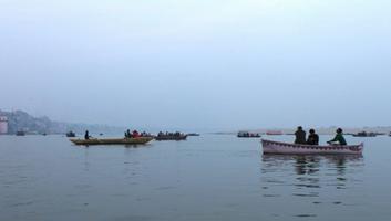
the magnificence of this holy landscape. Boat travel is the best way for
visitors to understand the entire ghat landscape. The east bank of the Ganga
with panoramic views of the river and the ghats contrasts with the liveliness
of the built up west bank.

ARCHITECTURE VOCABULARY OF GHATS –
When
experiencing the ghats on foot, the proximate senses are fully engaged but the
interpretation of visual elements is hindered. The visitor on a boat on the
Ganga, away from the hustle and bustle of the city, has the opportunity to see
the panoramic skyline of the ghats. The skyline holds significant architectural
value with its temple spires, fort like palaces with bastions, protruding
balconies, platforms, and cubicles just above water. The layering of structures
adds depth and serial repletion of forms provides the unifying thread in the
architectural diversity of the ghats. To identify repeating forms, walls,
stairs, vegetation, platforms and prominent spires on each the 84 ghats were
systematically represented in a graph format. The frequency with which each of
the elements occurs on the ghats is mapped. Although the elements are not
spaced at regular intervals, their erratic repetition sets up a syncopated
rhythm. The ghat architecture responds to the changing water levels of the
Ganga. The lower floors of palaces are opaque and built solid with octagonal or
circular towers to resist the thrust of the rising waters.
These are aligned with square,
rectangular, octagonal, and circular platforms built over well foundations that
divide the steps into bays and protect them from erosion. The platforms are
occasionally hollowed out into cubicles that house shrines. Smaller structures
are also built opening into the river--these are private spaces for bathing and
meditation. The upper floors of mansions are porous with windows, balconies,
and galleries for views of the riverfront. The steps set up an interesting
rhythm especially as they cascade down from streets and buildings located at
higher levels. The riverfront becomes greener towards the north with unbuilt
embankments and greater tree cover.

HERITAGE TRAIL -
Movement
is studied at three levels: from urban transportation hubs to the ghats, from
adjoining neighborhoods to the ghats, and between the ghats themselves. Streets
follow topography—those perpendicular to the riverbank connect parallel streets
to the ghats and drain storm water into the Ganga. The street network shows a
dendritic pattern with the major thoroughfares broad and straight, while the pedestrian
lanes of the old city are narrow and winding. They are crammed with people,
animals and vehicles, dark and unlit. Views and space for movement open up in
the ghats, but the ghats too become crowded on festive occasions and have their
own circulation problems with the boats, as there are few docking points.
Walking along the ghats takes about 4-5 hours. The five destination ghats for
tourists and pilgrims include Assi, Dashashwamedh, Manikarnika, Panchganga, and
Adi Keshav. It takes 10-15 minutes to drive from one to another, depending on
traffic, or 20 minute by boat. At peak times in the evening, vehicular movement
can be even slower than walking. The ghats are about 15- 40 minutes to the
train station and airport, by cars and auto-rickshaws. There are bridges that
cross the Ganga, but with narrow shoulders. The way finding map of Varanasi
Ghats is designed for aiding tourists when they are walking to and along the
ghats. It shows the traffic routes from the airports and railway station to the
ghats and its attractions. It also shows the street network, walking and boat
trails, and significant sites. Heritage trails proposed on six ghats: Assi
Ghat, Kedar Ghat, Dashashwamedh Ghat, Manikarnika Ghat, Panchganga Ghat, and
Adi Keshava Ghat and the historic buildings and temples are marked on the
detailed maps. Each ghat has its own small loop of heritage trail that connects
its historic buildings and temples. Trail-heads are at entry streets from the
city and boat docking points. The way finding map can be made available as an
app for smart phone. Visitors can scan the QR code on the way finding map
brochure and download the App. It has the map of Varanasi Ghats, local weather,
facilities nearby, myths and legends associated with each ghat, as well as historic
and sacred sites.

RAJ GHAT HERITAGE TRAIL –
The
Rajghat Trail connects the 83rd and 84th, ghats on the Rajghat Plateau at the
confluence of the Ganga and Varana. The sites are of immense archaeological and
religious significance offering lessons in both history and myth. On Rajghat
Plateau and further upstream along the Varana were the earliest settlements in
the region dating back to 11th BCE. Excavations in 1940s and 1990s revealed the
growth of rural hamlets at Akatha and Sarai Mohana into an urban center by
fourth century BCE in the Mauryan period. The historic city flourished under
different dynasties, its uninterrupted exitence coming to an abrupt end with
Islamic invasion. The site has the remains of fort of the Hindu Gahadvala
ruler, Jaichandra who was defeated by Qutb-ud-din Aibak in 1194-95 CE. The
Gahadvala rulers worshipped at the Adikeshava Temple at the confluence of the
Ganga and Varana using its ghat for bathing in the Ganga.
Their fort was never rebuilt and the city moved southwards but the sacred significance of the site located on the Panchkroshi pilgrimage circuit did not diminish. Adikeshava Temple was rebuilt at the end of eighteenth century and other smaller shrines containing linga such as Sangameshvara (god of river confluence) commemorate the presence of gods. The archaeological and sacred sites representing history and myth respectively are juxtaposed in space but their lack of physical connection precludes their reading as an integrated narrative and a historic timeline by the visitor. Ferryboats for trade used this part of the riverbank until 1887 when the bridge across the Ganga was built. Today Raj Ghat is accessed from the city through a major street and has new shrines including one to the medieval saint Ravidas above stone steps built in the 1980s. On its north a major storm water outlet from the city empties into the river and a squatter community lives close by.

To make the sites more
accessible jetties are proposed at Raj Ghat and Adikeshava Ghat for visitors
who choose to visit the sites in boats. A cultural heritage trail with
interpretive signage is designed linking Adikeshava Temple with the proposed
Archaeological Park around the ancient ruins of Varanasi. The areas along the
trail open up to expansive views of the Ganga. The heavily eroded river
embankment is redesigned as green terraced ghat to stabilize the soil and
encourage vegetable and flower gardens.
DIRECTIONAL SIGNAGE -
The
proposed signage system will increase landscape legibility by identifying ghats
clearly and aiding orientation. Two kinds of signs are proposed: informational
and directional. Informational signage covers public service, caution and
educational. Tourist center, emergency aid, drinking water, hotel, restaurant
and restroom, among others will be displayed as public service signage.
Examples of caution signage are no smoking and no littering. Educational
signage covers historic buildings, temples, sacred sites, myths and legends and
ritual ceremonies such as aarti. Directional signage will be placed on walls of
the buildings and streets to show the way from the city to the ghats and the
Ganga. In addition signage will illustrate the location of the ghat and its
name as well as boating areas.
According to one legend the five most sacred ghats represent different body parts of Lord Vishnu: Assi is the head; Dashashwamedha is the chest; Manikarnika is the navel; Panchganga is the thighs; and Adikesava is the feet. The five elements of all gross matter are sky, ether, fire, water and earth. Thus the five most sacred ghats can be identified in the following way: Assi as the sky, Dasashwamedha as ether, Manikarnika as fire, Panchganga as water, and Adikeshava as earth.

NARRATIVE SURFACES OF THE GHATS –
The urban landscape of Varanasi is replete with vibrant
folk art created by local artists. It can be found on building facades, street
walls, water tower, steps, and on the boats. There are different types of art
including paintings of gods and goddesses, murals, and sculptures. The themes,
style, and color palette for narrative art depicting myths and legends that
give identity to the ghats are modeled on urban folk art. Rest platforms,
lights, and planters are proposed as narrative surfaces for local arts on Assi
Ghat, Dasashwamedh Ghat, Panchganga Ghat, Manikarnika Ghat and Adikeshav Ghat.

GHAT LIGHTING –
Lighting of the ghats is uneven as there are hotspots
that are brightly lit in an otherwise poorly lit riverfront. Certain ghats are
lit during the evening aarti but travel between the major ghats at night time
is difficult as there is no lighting. From overly bright ghats to mysterious
dark corridors of the city, the lighting system in Varanasi is very sporadic.
The new lighting system works to evenly spread light along the ghats, creating
a safer space that is easily accesible. The lighting proposal includes bollard
lighting for the trails between the ghats, hanging lights for the narrow lanes
in the old city, step lighting so people can see their way down to the river,
spot lighting for the heritage buildings as well as for signage, and evacuation
lighting in emergency. The levels of ghat illumination, existing and proposed,
show where the light is most and least concentrated. The section cut shows
signage, path, and step lighting.

VENDING TYPOLOGY ON THE GHATS –
Vendors selling a myriad of items ranging from colorful silks to fruits to items used for worship, add to the chaotic atmosphere of the ghats both visually and physically. Though the vendor system may seem overwhelming and even disorienting at times to newcomers, it promises livelihood to many people. Stimulating to all of the senses, Varanasi's commercial landscape offers a compelling experience. Many commercial activities move, following the flow of pedestrian traffic. Merchandise overflows from corts and tables lining the streets. Standing shops entice with colorful displays of their goods, often hanging at eye level or above. Commercial activities create a dynamic landscape laden with color, texture, odor, and sounds, adding vitality to the scene. Although vending appears very haphazard initially, closer examination reveals a hierarchical arrangement of commerce along the street system and the ghats. This hierarchy is particularly apparent at Dashashwamedh Ghat, a popular tourist destination where many religious celebrations occur. Standing shops, often integrated into the lowest level of larger buildings, are set back the furthest from the flow of pedestrian traffic along the streets leading into the ghat. These merchants' locations are more or less fixed. Carts, items laid out on blankets to be pocked up at the days end, and make-shift tables, all semi fixed vendors, are a step closer to the passers-by. Mobile vendors carry their goods with them, moving easily with the changing tides of people.

DESIGN PROPOSAL FOR VENDING ON THE GHATS –
Congestion near the steps makes the narrow lanes leading
to the river nearly impossible to successfully navigate and vendors calling
their wares looked when they form
makeshift markets made from tarps and posts. The more mobile vendors should be
given a space to occupy and become an asset to tourists and pilgrims of
Varanasi rather than a source of stress. Through small interventions along
unused wall space on the ghats themselves, vendors are given a place to display
goods near major channels of foot traffic instead of clogging the narrow lanes,
Wall-mounted folding tables, garbage rings that hold plastic bags, and
collapsible tables that can be stacked and stored at the day's end all give
merchants an opportunity to better market their merchandise. Vendors can use
these furnishings by signing up through a vendor collective, being assigned a
table of their choice, and becoming responsible for the maintenance and security
of the table. The furniture can be collapsed and locked on the ghats when
vendors have finished their activities. Collapsible tables can be housed in a
semi-mobile vending kiosk that offers tourist maps and assistance to visitors.
A coding system can be outlined in the tourist map to show travelers where maps,
first aid, true information or transportation assistance available. When
tourists access this information via vendors they will perceive them as a
resource for their navigation through the city rather than a source of
harassment.

DESIGN PROPOSALFOR PERFORMATIVE LANDSCAPES –
ASSI GHAT -
Assi Ghat is one of the most popular ghats with easy access from the city. It received the patronage of Marathas in the 18th-19th c. The Jagannath Tem ple on the ghat is the replica of Jagannath Temple in Puri. Below of the footsteps is the linga of kundodareshvara Shiva under a Pipal Tree. In the after math of Assi Nala being diverted a kilometer to the south in 1980, the Ganga flow has receded from Assi Ghat, leaving a large exposed silt area. Located in the south end of the ghat stretch, it has relatively large open space with potential to be developed. However, the site is covered by large expanses of silt extending up to 120 feet from the steps. As a result, most activities occur on the unstable and uncomfortable silt-bed. Besides, the space between buildings and steps is not large enough for rituals. Seasonal flooding increases the water level resulting in lack of public space. The main activities include bathing in the holy Ganga River, worship of linga under the tree and in the temple, boat landing, praying and meditation, and the traditional aarti ceremony every evening.

Strategies for creating amphibious space including:
redesigning the ghals, inserting a floating stage for daily performance, and
linear floating piers connecting the steps and water edge. The main objective
is to enlarge the performance space and provide boat docking. The platform size
around the temple and sacred tree is extended. Curvilinear shapes replace the
original acute angle of the steps, thus preventing further silt deposit. A
floating stage on the hard revements wall extends the stage area for the aarti
performance. In the dry season the stage is supported by the wall, while during
the monsoon season, it floats up with the water level.

DASHASHWAMEDHA GHAT -
The floating dock consists of plywood 10 x 10' platforms
supported by styrofoam buoyancy billets. For it to be stable for six people on
board, the floatation capacity needs to be at minimum of 1300 lbs. For example
the 10' x 10' platform would weigh 400 lbs (100 x 4 lbs per sq. ft) and 6
people at 150 lbs each equals 900 lbs. Therefore floatation required is 1300
lbs (900 + 400). With the use of only four (17" x 20' x 8) billets (425
lbs each equals 1700 lbs floatation), the platform can at minimum bear six or
more people on board without capsizing. Also it can be combined and adjusted to
create more spaces. As more platforms are added, boat parking will also
increase.
The linear floating bridges, supported by two extra revetments
walls, connect the steps and water edge, on which people are able to walk on
both dry and monsoon seasons. On the west side of bridges, there are several
tall octagonal terraces for various activities during the dry season and
connect the bridges to the platform when steps are under water in the monsoons.
Dycel concrete revetments reinforce the embankment and prevent silt from
accumulating on the ghats. The boats will park along the concrete revetment in
the dry season and berth beside the floating bridges during the monsoon, thus
adding space for the large crowds that gather to watch the aarti ceremony in
the evenings.

MANIKARNIKA GHAT –
Manikarnika Ghat is the most popular site of cremation
where the funeral pyres are never extinguished with about 28,000 bodies burnt
every year. Cremation can be interpreted as the symbolic sacrifice essential
for regenerating the cosmos-the ghat is therefore the site of recurring
dissolution and recreation of the universe. It is associated with both Shiva
and Vishnu, eternally present at the site that is absolute space and where time
stands still. Here moksha, liberation from the cycle of rebirths is promised
and the Ganga washes away the pollution of death. Circumambulation of Varanasi,
the Panchkroshi Yatra, begins with a bath at Manikarnika Ghat.
The ghat is mentioned in a 5th c. Gupta inscription,
rebuilt in 1302 CE and renovated by the Marathas in 1735 CE and 1872 CE. The
Holkar queen Ahilyabai in 1795 CE built Tarakeshvara Temple where Shiva is
worshipped as Tarakeshvar, one who whispers the Taraka Mantra in the ear of the
dying. Early photo graphs of the ghats in 1922 and 1947 show cremation
occurring on tiers of the embankments. Today the process of cremation is
haphazard and spilling on to the floodplain. Stocks of wood in the narrow lanes
interfere with the mourning processions, and crowds of voyuristic tourists in
boats gape at the spectacle of death. The redesign of Manikarnika Ghat
organizes space by introducing 21 new cremation platforms in front of Bhuthnath
Temple with circulation spaces for mourners. A separate loading zone for wood
transported by boats is demarcated and movable screens for privacy are
proposed.

PANCHGANGA GHAT –
This ghat marks the confluence of five rivers-Ganga,
Yamuna, Saraswati, Kirana, and Dhupapa and has been popular among the faithful
since the 11th12th Gahadvala period. The great Bindu Madhav Temple, described
by Tavernier in 1665 CE, was an awe-inspiring structure, built by Man Singh,
ruler of Amber in 1585 CE. It was demolished by the Mughal Emperor Aurangzeb in
1673 CE and the imposing Alamgir Mosque built at the site. The Vishnu deity was
housed in small house nearby that came to be known as Bindu Madhav Temple. The
Maratha Peshwas repaired the ghat in 1735 CE, first constructed in 1580 CE.
Panchganga Ghat is associated with the Ramananda, the teacher of Vedanta,
Kabir, the bhakti poet and the great author Tulsidas wrote his book Vinaya Patrika
on this ghat. In October November every year during the Hindu Karttik month,
devotees bathe in the Ganga here in large numbers, as this is an auspicious
time. The ghat is lit up with tall bamboo poles with lamps to commemorate
ancestors.
The viewsheds to and from the Ganga are striking with
domes of the mosque and steep flight of stairs adding to the picturesque
effect. The Panchganga Ghat is difficult to access from the city as the streets
leading to it are narrow and labyrinthine plus there are encroachments on
public space and signs are lacking. Public space on the ghat too is inadequate
especially in the evenings when the aarti to the Ganga is performed. In the
redesign proposal performative space is added by linking the platforms extend.
ing into the Ganga. The plaza at the higher level between the mosque and the
temple overlooking the ghats is redesigned as a peace plaza to bring the Hindu
and Muslim communities together. Signage and lighting enhance the legible
quality of the public space.

PEACE GARDEN: HINDU AND MUSLIMS IN VARANASI –
Varanasi periodically witnesses communal violence between
Hindus and Muslims. Public spaces are potential sites of conflict and terrorist
activities. Al though Islam and Hinduism are antithetical in many respects, yet
interfaith dialogue can bring out the common ground and universal message of
both religions. In our proposal the ghats are conceptualized as spaces of
negotiation and reconciliation. Peace garden is proposed as a design prototype
for encouraging communication and promoting activities that lead to greater
understanding of shared humanity beyond religious differences
Between the eleventh and seventeenth centuries the temples of Varanasi were destroyed at least four times but the remarkable resiliency of the sacred sites is attested in rebuilding of temples. The history of repeated destruction of temples and building of mosques at the sacred sites of Hinduism can be read in the cultural landscape of Varanasi even today. Although it may be difficult to overlook reminders of the past, this history should be put into perspective and read as chronicle of not just conquest and destruction but also harbinger of the hybrid Indo-Islamic culture in music, arts, cuisine, and myriad economic transactions.

In spite of occasional conflicts, residents of Varanasi
with different religious backgrounds share an easygoing life style, marked by
bonhomie. Although a minority forming about a quarter of the population,
Muslims plays an important role in the urban economy. Weaving is one of the
largest industries in Varanasi, and about 70% of weavers are Muslims. At Balaji
Ghat, the historic palace with the Balaji Temple built by the Peshwas in 1735
CE is now being renovated for public use. It is adjacent to the Alamgir Mosque
built on a site dedicated to Bindu Madhav Temple first built in the eleventh
century and then again in the sixteenth century, finally demolished a century
later.
This juxtaposition of Hindu and Muslim religious sites is
as an ever present reminder of the diversity and pluralism of Varanasi. Balaji
Palace has an open terrace offering a panoramic view of Ganga where a public
plaza/garden is proposed. The peace garden uses traditional Indian weaving
patterns, heritage common to all living in Varanasi. The garden design does not
use religious symbols --it is simply a community space that brings people
together for interfaith dialogue and shared meals on Hindu and Muslim
festivals. The prototypical peace garden can be inserted at several sites along
the riverbank where communal violence has occurred in the past such as Gola
Ghat, Kedar Ghat, and Assi Ghat.

HEALTHY AND RESILIENT LANDSCAPE
The physiography of the Ganga's banks is mapped in site hydrology-Ganga and Varuna flow in summer and monsoon, flood and drought conditions, in land water bodies; terrain of ridge, hills, floodplain; and soils and vegetation. Ganga, the archetypal river of purity washing away physical dirt and moral sins, is now polluted because of the large amount of waste generated at the ghats and by the city. Ritual worship and bathing, cremation, and sewage cause the Ganga water to be contaminated and a health hazard. The ghats in Varanasi are envisaged as a healthy landscape by reducing point source pollution in the Ganga and creating a clean land water interface through public sanitation programs and design prototypes such as non-polluting bathing fonks, compost gardens, biofiltration basins, and ghat recycling center. Natural cleansing systems, such as wetlands and phytoremediation treat wastewater and increase biodiversity. Local composting and recycling are proposed to reduce the biodegradable waste. Bathing tanks are designed with bio-filtration basins for de creasing contaminants in the water, thus promoting the health of the river and of those who engage with it. Dumping sites near the ghats are reclaimed as waste management facility in a landscape of marshy lagoons for phyforemediation. The urban sanitation and composting programs should aim to limit river BOD (biological oxygen demand) to a safe level by 2030. Education through the use of on-site murals and other media to promote proper waste disposal and recycling will positively engage the community in ensuring a clean environment.
The Ganga is flooding more often because of de
forestation upstream and constriction in its flow locally caused by silt
deposition on the east bank. Frequent flooding negatively impacts the ghats and
the city above them. Their resiliency, i.e. their ability to recover rapidly
from disaster and prepare for as well as prevent future catastrophes from
recurring, is increased through site planning and design. By reclaiming inland water
bodies, and restoring Varuna River and Assi Nola watersheds as greenways,
resiliency of the urban landscape to cope with flood events is improved. In
this ecological approach, on the northern stretch of ghats, planted edges and
constructed wetlands are recommended. The width of the river is increased by
silt removal thus allowing the rising waters to spread on the east bank. This
shifting fluvial landscape is reclaimed as public space that can be used
intensively in the dry season for recreational activities thus alleviating the
stress on the ghats. Building wetlands that act as biofiltration basins and
planting memorial groves that recycle cremation ashes as fertilizer in sediment
fills in upland areas stabilizes the landscape.
ANALYSIS OF SITE HYDROLOGY –
The Ganga meanders through the Indo-Gangetic plains of Northern India leaving traces of erosion and deposition of sediment transported by the River. The holy city of Varanasi and its majestic ghats on the western bank sit on the erosion edge while the east bank is the deposition edge. On the highly constructed west bank there is visibly less erosion. The water level of Ganga fluctuates through the year affecting the ghats; however the normal water level is 65.37 meters, allowing the various rituals and other activities to occur. In drought the water level is around 60 meters above the mean sea level that results in exposing the silt bed. Due to climate change the frequency of flooding is increasing, occurring now at every five years interval. The highest level of flood recorded as 73.90 meters is well above the 71.26 meters considered to be the danger level completely submerging the ghats. The 100 year flood will cover all parts of the ghats, including temples and historic buildings.

The flooding and silting is a threat to the cultural
landscape and design intervention should take into account the flooding cycle
as well as the process of erosion and deposition. The mild slope of the east
bank is continuously covered with layers of silt deposition every year. With
deforestation in the Himalayan foothills, sediment loads in the Ganga are
increasing. The sand bed formed in the flood plain expands laterally and
increases in height with the downstream flow, the maximum elevation being
Prahlad Ghat. In the absence of sand mining on the east bank the width of the
river is constantly decreasing. Due to this decrease there is constant pressure
on the built edge that may result in collapse of the Ghats in future.
ANALYSIS OF TERRAIN –
Mapping the terrain of Varanasi at 15 meter intervals
revealed the high ridge on the west bank marked by three hills associated with
the trident of Shiva. The promontories are the nuclei of three sacred regions
of Varanasi-Omkareshwara Khanda in the north close to the confluence of River
Varuna with Ganga, Kedareshvara Khanda in the south close to Assi Nala, and
Vishveshvara Khanda in the center. The high elevation of the west bank has made
it suitable for urban settlement.

MAPPING OF SOIL AND VEGETATION –
Soils and vegetation mapping of east and west banks of
the Ganga points to several problematic issues. The soil is mostly sandy or a
sandy loom and not an ideal medium for vegetation growth. Furthermore, it is
not appropriate for building, as it does not have much support. The west bank
of the Ganga is densely built up with the ghats and has only a sparse number of
trees struggling for survival. In the northern section of the ghats, there is
denser vegetation due to the Varana River and for fewer building structures.
Many trees found in this section such as banyan and peepal trees have sacred
associations. The farmland across the river is located on higher ground. Seasonal
farming is done on the northern part of the west bank and towards the southern
part of the east bank where the flood plain soils can support vegeta-bles and
fruits.

DESIGN PROPOSAL FOR SEASONAL PARKS ON THE GHAT –
Stretches of the west bank with a hard slope between the
ghats are currently unused or just being used for drying. The land in these
areas can be terraced opening up new possibilities. Pocket parks with small
areas for vegetable gardening and clean bathing tanks are proposed.
Furthermore, drying areas for washer men can still be provided. This will help
create a more sustainable community space and add more greenery along the
ghats. It could potentially lessen congestion from the more dense areas as
well. Additionally, green terracing will help with erosion problems on the
unbuilt slopes caused by flooding. In the vegetable semihard-scape local
sandstone will be used to construct the terraces and native trees and grasses
will be planted.

GANGA RIVER POLLUTION –
The ghats are littered with rubbish and it is not uncommon
to stumble into rotting piles of offerings. Some of this waste finds its way
into the Ganga, littering the shoreline and bobbing along with the current.
Occasionally the horrifying sight of a floating half-cremated body can be seen.
This calls into question the purifying powers of the holy river. Although
industrial waste from the upper Ganga basin in Uttar Pradesh can account for
some of the con lamination of the Ganga, Varanasi city contributes to 350
million liters of sewage each day. Sewage and domestic waste drains into the
river with only about one third of it processed by sanitary treatment
facilities. The biochemical oxygen demand in the Ganga, a measure of
contamination, increases by more than 500 percent after passing through
Varanasi. Sewage treatment plants are operating over-capacity and waste
management programs are not effective. Point source pollution from the street
sewers pours into the river at locations shown on the map while non-point
source pollution from industry and agriculture adds to the overall
contamination levels.
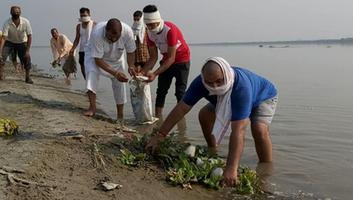
Ritual offerings and the plastic bags they are carried
in, washing of clothes and bodies, animal waste, 7000 tones of ash released
from about 88 cremations every day and 300 tones of charred human flesh have
made the Ganga unhealthy. Biodegradable and non-biodegradable waste products
generated on the ghats should be properly disposed of in an effort to reduce
the amount of waste entering the river. Without urgent measures to mitigate
pollution this cultural, natural, and spiritual resource will threaten the
safety of those who interact with it.
COMPOSTING ON THE GHATS OF VARANASI –
Implementing a compost program in Varanasi offers a
productive use for biodegradable waste currently point source pollution for the
Ganga. Ritual offerings, animal waste, food scraps and other compostable
materials rot on the steps when they could be transformed into a productive
growing medium. In the proposed system compost production would happen at two
scales: at a smaller scale on the ghats themselves and as part of a larger
solid waste management system. Site furnishings for composting include waste
receptacles that sort garbage, recyclables, and compost materials, a well as
compost bins, compost tumblers, and solid waste transport boats that collect
the sorted waste and take it to the solid waste management center on the north
and east banks. The waste management center would handle garbage incineration,
recycling, and compost production for nearby fields. The site-specific
composting would utilize landings as miniature community gardens, and place
tumblers, waste receptacles, and rolling bins at strategic points along the
ghat stretch.
A precedent for community members reclaiming ghat space
for plant production exists already on the Rana Pratap Ghat. The compost
gardens would be similarly socially engaged involving local community members.
Compost site furnishings must be made from local materials. The tumbler barrels
can be reclaimed from nearby industrial plants. Wooden frames to house trash
bags, bins, and the tumblers themselves can be made from recycled lumber from
old boats. The low, stacked-brick growing beds like those on the Rana Pratap
Ghat garden can withstand flooding if properly constructed and filled in with
new soil at the beginning of each new season. Tumblers, bins, frames and trash
bags, on the other hand, are all sufficiently mobile to be moved during the
monsoon. With the proper utilization of local materials, education, and
community engagement, composting can be a com. munity resource and a long term
sustainable solution for waste management.

DESIGN TYPOLOGY OF GHAT PLATFORMS –
Bathers in the Ganga are exposed to contaminants through direct contact with water that has untreated effluent and waste. Pollutants are released into the Ganga when pilgrims bathe due to the use of soaps, or other detergents that contaminate the water. The prototype of the private bathing tank with filtration systems is designed to solve the water contamination problem. Biofiltration systems under the two octagonal platforms improve the water quality by pumping and releasing clean water from and to the Ganga. This ensures that the Ganga is not further contaminated, but most importantly, to keep the bathing tank clean for pilgrims. The private bathing tank is most needed in Dashashwamedh Ghat as well as in many other ghats that are bathing hotspots along the sacred Ganga. The form is derived from existing design typologies of bathing structures on the ghats. The private bathing tank fulfills the crucial need of having a clean bathing environment in the Ganga.

GROUND WATER CONTAMINATION AND DEPLETION -
There is an acute shortage of water in Varanasi because the water supply system is over a century old and the distribution system is inadequate About 55% of water supply needs are met by tube wells and hand pumps leading to ground water depletion. The adequate solid waste management and absence of sanitary water treatment plagues the ghats landscape and increase pollution in the Ganga. The city's high resident and floating population strains current municipal facilities for beyond their functioning capacities, which leads to large amounts of untreated waste water being expelled directly into Varana and Ganga Rivers and the failure to collect approximately eighty six metric tons of waste in the city every day. The combination of intermittent power loss, fluctuation in the Ganga velocities, rising and falling levels as well as outdated, poorly managed treatment facilities has resulted in deterioration of public spaces and increasing groundwater pollution.

The region once had an extensive system of natural and
manmade water bodies called talabs and kunds respectively. In ancient times,
these water bodies were constructed and used strategically to collect and store
water for times of drought while unintentionally providing a natural
groundwater recharge and filtration system for the city. As Varanasi expanded,
these water bodies were encroached upon, depleted for drinking and irrigation
water as well as filled in for urban development. The present situation of
amassing uncollected garbage has forced the community into establishing
large-scale community dumping grounds on the outskirts of the city, as well as
filling the low lying areas and ponds, i.e. what remains of the ancient water
body network within the city with rubbish Studies on groundwater quality in
Varanasi show that the most vulnerable points for groundwater contamination
were in public areas filled with waste.
VARUNA RIVER
ACTION PLAN -
The main objectives for the Varuna Action plan are: 1.
Reclaim interstitial urban voids and remediate existing polluted water bodies
into a green and blue network to generate a rediscovered public domain. 2.
Limit the amount of untreated wastewater directly entering the rivers and open
water bodies. 3. Modify Current agricultural practices along the Varuna River
to establish a riparian buffer corridor and utilize oil-bearing crops to
sequester heavy metals in the soil and avoid public consumption of crops laden
with toxins.
The site design includes a connected system of passive
storm water management strategies: subterranean infiltration trenches,
greenways, and a waste water treatment recreation area comprised of retention
ponds for settling and a constructed wetland organized specifically for
treatment of water contaminated with heavy metals and sewage. The large former
community dumping area will serve as a potential space for a waste management
facility as well as a site of extensive phyloremediation. This recreation area
will connect the currently underappreciated archaeological site with the
proposed cultural heritage trail and the main transportation hubs of the city.

ASSI NALA WATERSHED HERITAGE PLAN
In ancient times, inland water bodies dotted the
watershed of Assi Nala, and they drained and stored water. During monsoons the
overflow from the talabs drained into the Gange. As the water level of the
Ganga increased the overflow and the river mixed. A few years ago, Assi Nala
was diverted southwards, so part of original Assi Nala lost its capacity to
drain water to the Ganga. The new Assi drain has more strong drainage capacity,
and the flow of the waters faster; however the inland water system is
destroyed, and the city floods frequently in the monsoon sea son. Currently the
watershed of Assi Nala is heavily encroached, and the urban hydrology is
disturbed. In order to deal with city floods, it is proposed to reintroduce the
original hydrology by changing the street section and increasing the street
capacity to hold overflow during the monsoon season. The important historical
and sacred sites in the area can be linked by the proposed heritage trail along
this part of Nala.


SITE ANALYSIS OF EAST BANK -
The east bank is a flood plain flooded with water as the
Ganga swells in monsoon leaving layers of silt and sand deposition along the
convex shore line. The higher sand mounds and lower alluvium is a shifting
landscape changing with the season and with the Ganga's flow. There is seasonal
farming of watermelon and bitter gourd. The flood plain offers panoramic views
of the ghats and is used for recreational activities such as pony rides and
picnics. Aghoris have set up camps and have made sand lingas for worship.
The east bank is redesigned with the fluvial process of
successive deposition. The low-lying areas are proposed as retention ponds
planted with grasses for bio-filtration to occur. The intermediate level with
rich alluvial deposits is designated for seasonal farming.
The highest level is planned for public use with the
maidan (large public space for multifunctional use) in axis with Dashashwamedh
Ghat on the west bank. During monsoon flooding the high points are still
usable. Sand dredged from the shoreline can be used to fill the low-lying area
below the farmland where a memorial grove is proposed. Sand dredging will
increase the width of the Ganga flow by 300 meters and less en the pressure on
the west bank. Walking trails are proposed on ridges formed by accelerated
natural process where the sand on the site is mixed with the bacteria Bacillus
pasteurii forming into sandstone.

DESIGN PROPOSAL FOR MEMORIAL GROVE ON THE EAST BANK –
Approximately 300-400 bodies are cremated every day on
the banks of the Ganga. The ashes of a cremated body weigh roughly between 1.8
and 2.7 kilograms, or 4-6 pounds. Each day, as these bodies are cremated at
ghats such as Manikarnika, a startling amount of ashes accumulates between 544
and 1088 kilograms, or 1200-2400 pounds) at these sites, and much of it is
dumped in the Ganga. Though intended as a positive spiritual act to ensure the
soul's passage into heaven, these ashes are contributing to the Ganga's
unbelievable levels of pollution. To reduce the pollution the concept of the
East Bank Memorial Grove where ashes would be preserved was developed. The soil
construction of the Memorial Grove applies the Biourn system at a much larger
scale. Biourns are composed of two layers of soil one upper organic layer
housing tree seeds and a second layer that incorporates cremated ashes of loved
ones. These layers are encased in a biodegradable "urn" that is
planted in the ground. As the seeds germinate in the first layer of soil, the
growing roots penetrate the ash layer and use the ash as fertilizer.
The idea of the Memorial Grove system is to use composted
materials in topsoil to create a suitable environment for seeds to germinate,
and then penetrate the deeper ash layer of soil as the roots grow. Because the
Grove lies in a low-lying area of the East Bank, sediment fill from the
shoreline into this area is proposed along with the planting of several banyan
trees in order to stabilize the area and help it withstand flooding. The
Memorial Grove design incorporates a series of elevated platforms and walkways
created from recycled wood. These large platforms allow for various activities
including prayer, rituals, picnicking, and other recreational activities. These
platforms act as openings in the grove, and are in the vicinity of one large
memorial tree and a few smaller trees, or a small grouping of three memorial
trees. The East Bank Memorial Grove is a site for remembrance, spirituality,
recreation, and education.

CONCLUSION -
The Ganga Action Plan has not been completely successful so far in part because it is guided by a top-down planning approach. In this engineering approach, cultural practices, folk beliefs, and local community traditions are ignored. The multiplicity of stakeholders, widespread encroachment of public land, and ineffective and inadequate local ordinances are some of the challenges in conserving the Varanasi ghats. Site planning and management should take into account what is today considered non-essential knowledge—the esoteric language of myths, hidden meanings of rituals, and sanctity attributed to nature evident in everyday practices so that a new culture specific, participatory model for solving complex problems can emerge. This bottoms-up eco-cultural approach advocates the use of appropriate technology, local materials, and renewable energy sources. Programs such as vending collaborative and on-site composting will engage the local communities and improve the local economy. Greening of the west bank embankment and seasonal farming on the east bank of Ganga and Varuna banks are ecologically sensitive land uses. Recycling cremation ashes in the memorial grove is an invented cultural tradition for environmental remediation, in keeping with the ethos of sacred landscape. Amphibian space created in floating platforms responsive to fluctuating water levels and bio-filtration bathing tanks promote cultural traditions gradually being abandoned. Public spaces reclaimed as peace plazas and reclaiming surfaces as narrative spaces have the potential for healing communal strife and reviving urban art folk practices. Heritage conservation can thus become an empowering tool for local communities and for the visitor an opportunity for spiritual growth.
Email or Message Us Directly.